
Reston
Quick Facts at a Glance
Jurisdiction Type: Unincorporated community in Fairfax County, Virginia. The Reston Association (RA) is a private homeowner association that manages community amenities, open spaces, and covenants for most residential properties; it is not a municipal government.
Population: ~65,000–67,000 residents
Land Area: ~16.3 square miles
ZIP Codes: 20190, 20191, 20194
County: Fairfax County, Virginia
Adjacent Communities: Herndon, Great Falls, Vienna, Oak Hill, and Sterling (Loudoun County)
Distance to Washington, D.C.: ~23 miles west of downtown Washington, D.C. via the Dulles Toll Road (VA-267)
Metro & Transit Access: WMATA Silver Line service at Reston Town Center Station and Herndon Station; Fairfax Connector bus service throughout the community
Avg. Metro Commute to D.C.: ~40–55 minutes to downtown Washington, depending on destination and transfer requirements
Key Roads & Highways: Dulles Toll Road (VA-267), Fairfax County Parkway (Route 286), Reston Parkway, Wiehle Avenue, and Route 7 (Leesburg Pike)
School System: Fairfax County Public Schools (FCPS)
Founded / Established: Founded in 1964 by Robert E. Simon as one of the nation's first modern planned communities
Community Features: Extensive trail network, numerous parks and lakes, Reston Town Center, community pools, tennis courts, and preserved open spaces managed by the Reston Association
Walk Score®: Reston Town Center ~72–78 (Very Walkable); outer residential areas ~35–50 (Car-Dependent)
Overview & Geography
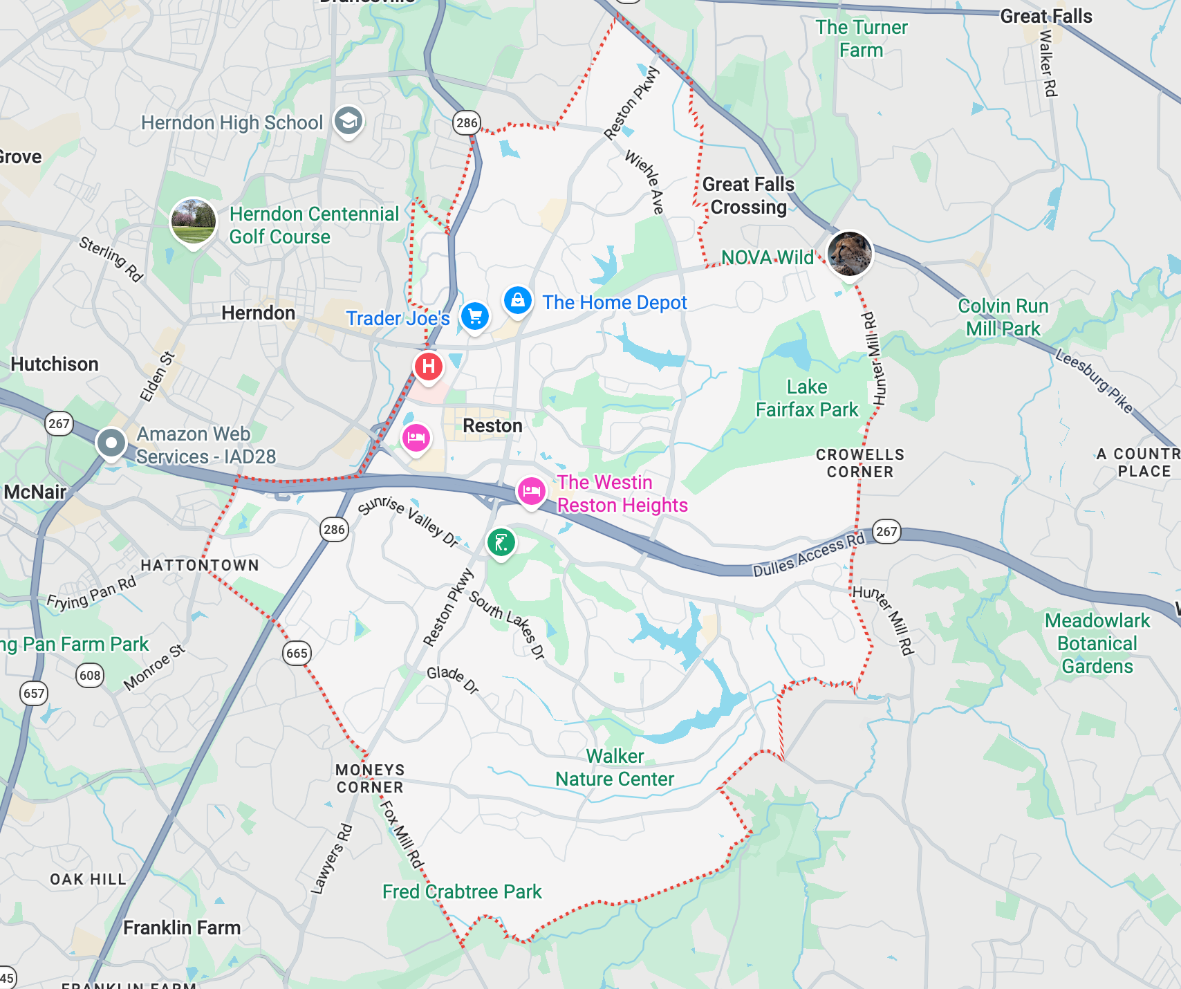
Reston, Virginia is a master-planned community located in the western portion of Fairfax County, approximately 23 miles west of Washington, DC. Robert E. Simon purchased approximately 6,750 acres in 1961 and founded Reston in 1964 — deriving the community name from his own initials (R.E.S.). Simon's founding vision centered on racial and economic integration, mixed land uses, and preservation of natural open space, making Reston one of America's first intentionally diverse planned communities.
Reston is divided by Lake Anne, Lake Thoreau, Lake Newport, and Lake Audubon — four man-made lakes that serve as both recreational assets and stormwater management infrastructure. The community encompasses approximately 1,380 acres of open space managed by the Reston Association, including woodlands, meadows, and 55+ miles of paved pathways connecting neighborhoods, village centers, and Metro stations.
Named Neighborhoods & Communities
Reston contains several distinct residential clusters, village centers, and mixed-use corridors. Below are the primary named areas, grouped geographically:
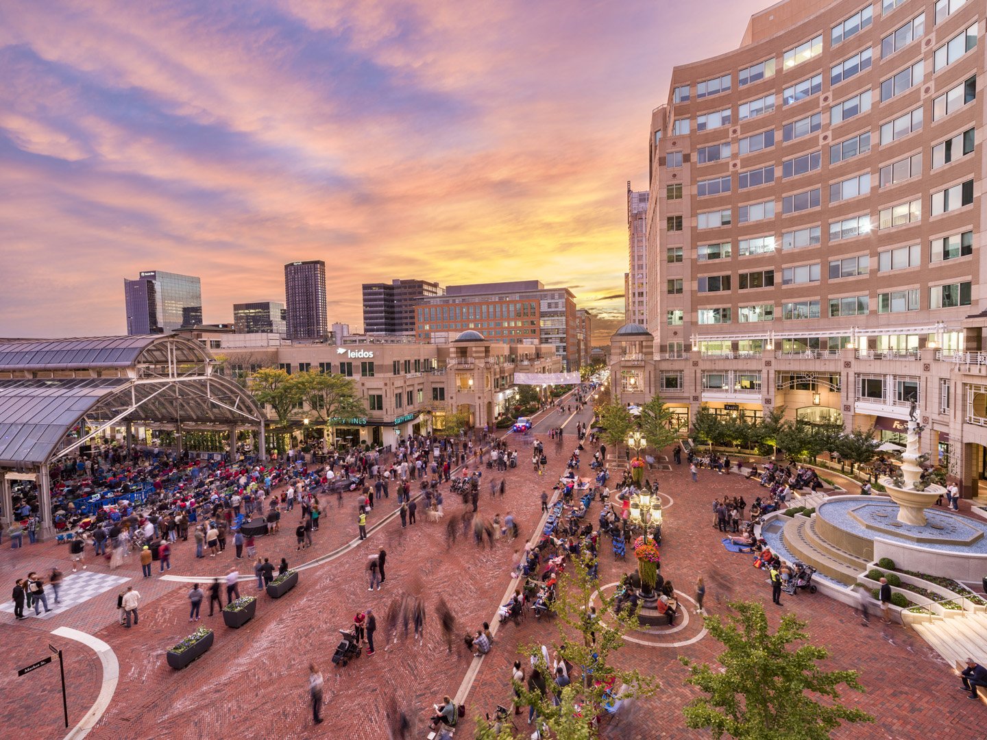
Lake Anne Estates — Lake Anne Estates offers a rare Reston lifestyle: quiet homes near one of Northern Virginia’s most iconic village centers. This area sits near Lake Anne Plaza, the historic heart of Reston, with trails, water views, cafés, shops, public art, and community events close by.
Beacon Hill — Beacon Hill is one of Reston’s special lake-area neighborhoods. It sits near Lake Audubon in South Reston and feels quiet, green, and tucked away. The neighborhood has a mix of detached homes on Beacon Place and lakefront townhomes on Beacon Heights Drive.
Lake Audubon — Lake Audubon is one of South Reston’s most loved lake neighborhoods. It offers quiet streets, wooded paths, water views, and easy access to daily needs. The lake itself was built in 1979 and is about 44 acres, with a maximum depth of about 21 feet.
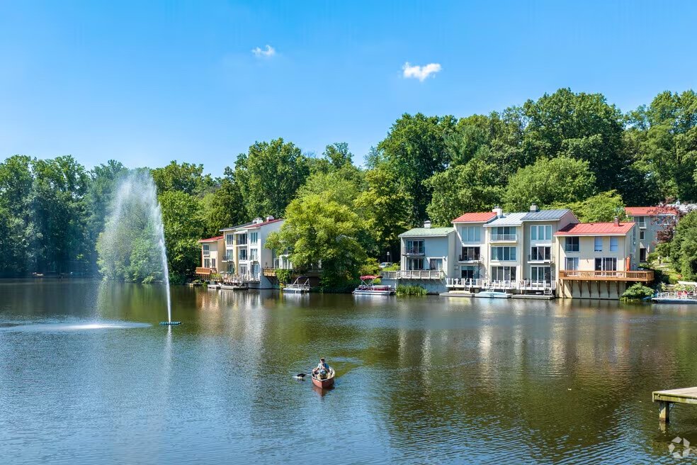
Lake Thoreau — Lake Thoreau is one of Reston’s most loved lake neighborhoods. It offers calm water views, wooded paths, modern townhomes, condos, and some single-family homes. The feel is quiet and natural, but still very close to daily needs. The neighborhood sits near South Lakes Village Center, at South Lakes Drive and Twin Branches Road, with shops, dining, and services close by.
Reston Station — Reston Station is one of Reston’s most modern places to live. It sits right by the Wiehle-Reston East Metro station on the Silver Line. That means you can step out your door and connect to Tysons, Arlington, Washington, D.C., and Dulles Airport without relying only on a car. This neighborhood has a city feel, but it still belongs to Reston.
North Reston Estate — North Reston Estates offers a quiet, green Reston lifestyle with larger homes, wooded streets, and easy access to everyday needs. It feels peaceful, but it is still close to Reston Town Center, Lake Newport, North Point Village Center, trails, parks, and major commuter routes.
Transit, Commute & Walkability
Metro Rail — Silver Line
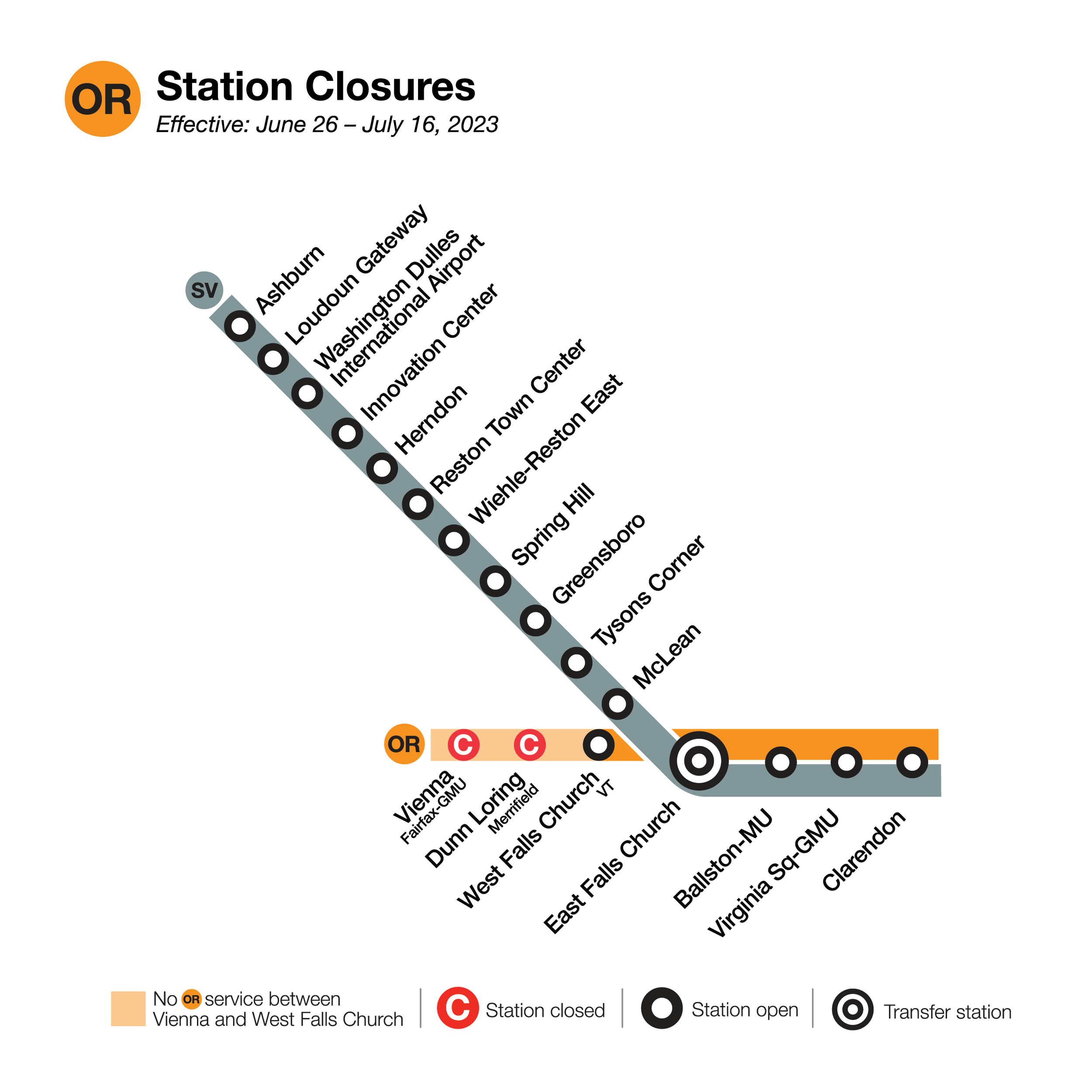
Reston Town Center Station — provides direct service into Tysons, McLean, and downtown Washington, DC (Metro Center: approximately 40–45 minutes off-peak).
Herndon Station — serves western Reston and Herndon residents; walkable from portions of western Reston ZIP 20170.
The Silver Line connects Reston to the broader Washington Metro system via the Orange and Blue lines at Rosslyn and Metro Center, providing rides to Reagan National Airport (DCA) and Union Station.
Bus Service
Fairfax Connector — Fairfax County's primary bus network operates multiple routes connecting Reston neighborhoods to Metro stations, Tysons, and Dulles International Airport (IAD).
Washington Metropolitan Area Transit Authority (WMATA) Metrobus — Select routes serve Reston corridors, connecting to the broader regional bus network.
Road Commuting
Dulles Toll Road (VA-267 / Dulles Access Road) — Primary east-west arterial connecting Reston to Tysons (approximately 10–15 minutes) and to downtown DC (approximately 30–50 minutes depending on traffic and tolls).
Fairfax County Parkway (VA-286) — North-south connector linking Reston to Springfield, Herndon, and points along the I-95 corridor.
Reston Parkway — Major north-south internal connector running through the community from Baron Cameron Avenue to the Dulles Toll Road.
Wiehle Avenue / Town Center Parkway — Key internal corridors connecting residential areas to Reston Town Center and the Metro stations.
Walkability & Bike Infrastructure
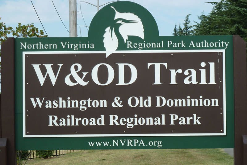
The Reston Association maintains over 55 miles of paved pathways and nature trails connecting all village centers, Metro stations, parks, and residential clusters. The Washington & Old Dominion (W&OD) Trail passes through Reston, providing a continuous paved multi-use trail stretching 45 miles from Arlington to Purcellville, Virginia. Walk Score varies significantly by sub-area: Reston Town Center core scores approximately 72–78 (Very Walkable), while outer residential clusters score 35–50 (Car-Dependent). Bike-share stations (Capital Bikeshare) are available near the Metro stations and Town Center.
Parks, Landmarks & Community Life
Named Parks & Natural Areas
Lake Anne — Reston's original focal point (created 1964) waterfront dining at Lake Anne Plaza and connecting pathways.
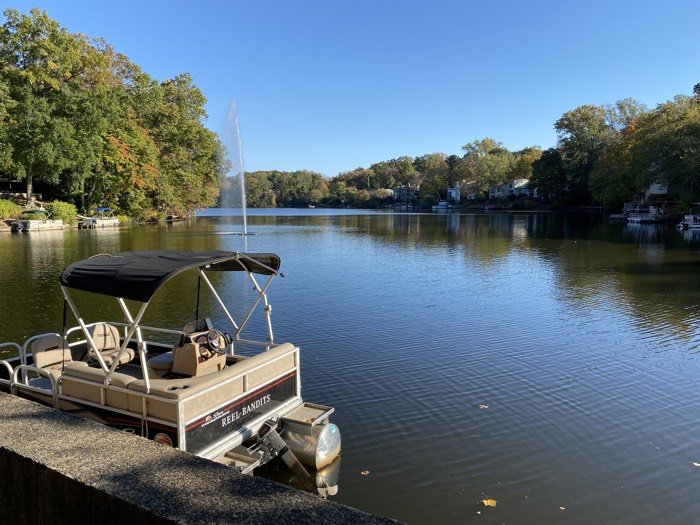
Lake Thoreau — Centrally located lake with a public beach for Reston Association members, surrounded by wooded trails; used for fishing, kayaking, and community events.
Lake Newport — Southern Reston lake with boat ramp access and connecting RA pathway network.
Lake Audubon — A quieter, natural-feel lake in southeast Reston surrounded by mature forest and residential clusters.
Brown's Chapel Park — A Fairfax County Park Authority facility featuring athletic fields and picnic areas.
Reston Regional Library (Fairfax County) — Located near North Point Village Center; serves as a community gathering, programming, and resource center.
Walker Nature Center (Reston Association) — An environmental education center on 72 acres of natural land, offering naturalist programs and guided trail walks.
Historic Landmarks
Lake Anne Plaza (National Register of Historic Places) — Listed on the National Register of Historic Places; designed by architect Conklin & Rossant and completed in 1965; modeled loosely on Italian hill-town plazas; the oldest surviving village center in Reston.
Reston Museum (formerly Lake Anne Fellowship House) — Documents the history, planning vision, and social legacy of Reston as one of America's pioneering planned communities.
Recurring Community Events

Lake Anne Farmers Market — Held Saturday mornings at Lake Anne Plaza from late spring through fall; one of Northern Virginia's longest-running community farmers markets.
Reston Multicultural Festival — Annual festival at Reston Town Center celebrating the community's founding commitment to diversity and inclusion.
Reston Town Center Pavilion Concert Series — Free outdoor concerts held at the RTC pavilion during summer months.
Friday Evening Live (FEL) — Seasonal outdoor music series at Lake Anne Plaza, typically running spring through summer.
Reston Holiday Parade & Tree Lighting — Annual community tradition held at Reston Town Center in November/December.
Reston Tri / Lake Thoreau Triathlon — Annual triathlon using Lake Thoreau and surrounding community pathways; attracts regional participants.
Arts & Culture
The Greater Reston Arts Center (GRACE) presents contemporary visual art exhibitions and education programs at Reston Town Center. The Reston Community Center (with locations at Hunters Woods and Lake Anne) offers performing arts, fitness, and cultural programming year-round.
Frequently Asked Questions
Is Reston, Virginia a city or an unincorporated community?
Reston is an unincorporated, master-planned community located within Fairfax County, Virginia — it is not an independent city or town. Reston has no separate municipal government, does not levy its own taxes, and is served by Fairfax County government agencies for services such as police (Fairfax County Police Department), schools (Fairfax County Public Schools), and zoning. The Reston Association (RA) is a private homeowners association that manages community open spaces, pathways, pools, and covenants for most residential parcels, but it is distinct from municipal governance.
Which Metro stations serve Reston, and what line do they operate on?
Reston is served by two Washington Metro Silver Line stations: Reston Town Center Station and Herndon Station (which sits at the Reston-Herndon border). Both stations are on the Silver Line, which runs between Ashburn in Loudoun County and Largo Town Center in Prince George's County, Maryland. From Reston Town Center Station, riders can reach Tysons Corner in approximately 12–15 minutes and Metro Center in downtown Washington, DC in approximately 40–45 minutes during off-peak hours.
What school district serves Reston, Virginia, and which high school do most Reston students attend?
All students living in Reston attend schools within Fairfax County Public Schools (FCPS), the largest school division in Virginia. School assignment is determined by residential address; families should confirm their specific school through the FCPS School Locator tool.
Who founded Reston, and when was it established?
Reston was founded by Robert E. Simon, a New York real estate developer who purchased approximately 6,750 acres of land in Fairfax County, Virginia in 1961. Simon began developing the community in 1964, naming it using his own initials (R-E-S-ton). His founding vision was unusually progressive for the era: Reston was intentionally planned as a racially and economically integrated community with a balance of residential, commercial, and recreational uses, and with significant natural open space preservation. The community's first residents moved into the Lake Anne Village Center area in 1964–1965.
What are the most walkable areas in Reston, and does Reston have bike infrastructure?
Walkability in Reston varies significantly by neighborhood. The Reston Town Center core area is the most walkable, with a Walk Score of approximately 72–78, offering pedestrian access to restaurants, retail, hotel amenities, and the Silver Line Metro station within a compact urban grid. Outer residential cluster neighborhoods are largely car-dependent, scoring 35–50. For cycling and pedestrian movement throughout the community, the Reston Association maintains over 55 miles of paved pathways connecting all village centers, Metro stations, parks, and residential areas. The Washington & Old Dominion (W&OD) Trail, a 45-mile paved multi-use trail running from Arlington to Purcellville, passes through Reston and provides regional connectivity. Capital Bikeshare stations are available near both Reston Metro stations.
Our Reston Market Expertise
Our team brings deep, transaction-tested knowledge of the Reston real estate market, including the distinctions between Reston's village-centered neighborhoods, lakefront communities, golf course properties, townhome enclaves, and the growing number of Metro-accessible developments along the Silver Line corridor. We have guided buyers and sellers through Reston's diverse housing market, from condominiums and townhomes to luxury single-family homes throughout this nationally recognized planned community.
Services We Offer Reston Buyers and Sellers
Buyer Representation — Expert guidance on Reston home search, neighborhood selection, competitive offer strategy, school-zone verification, HOA and Reston Association considerations, and Silver Line commute options.
Seller Representation — Comprehensive listing services including pricing analysis, professional photography, targeted digital marketing, property preparation guidance, and negotiation.
Ready to explore Reston real estate? Contact our team today for a no-obligation consultation. We are available by phone, email, and in-person meetings to discuss your specific goals in the Reston real estate market.
Thinking About Living in RESTON?
Buying a home is about much more than square footage. Our free Reston Neighborhood Guide helps you compare neighborhoods, schools, commute options, parks, dining, lifestyle, and local insights so you can find the community that fits you best.
Download the Free Reston Neighborhood Guide:
→ GET GUIDE HERE
Authoritative Resources for Reston Research
The following sources provide verified, primary-source information for buyers, sellers, and researchers exploring Reston, Virginia:
Reston Association — Official site of the Reston Association; contains current RA assessment rates, community rules and design standards, amenity information (pools, tennis courts, pathways), and cluster association directory.
Reston Town Center — Official Reston Town Center website listing current tenant retailers and restaurants, upcoming events, parking information, and the pavilion concert schedule.
Fairfax County Public Schools — School Locator — FCPS address-based school assignment tool; allows users to enter a Reston address and confirm elementary, middle, and high school assignments based on current attendance boundaries.
Fairfax County Government — Reston Planning District — Fairfax County's official planning portal for the Reston area; contains the Reston Master Plan, development application history, and land-use policy documents.
Reston Museum — Archives and exhibits documenting Reston's founding by Robert E. Simon, the community's planning history, and its evolution as a pioneering American planned community.
Washington Metropolitan Area Transit Authority (WMATA) — Official Metro system map and station information, including Silver Line schedules, fare information, and service alerts for Reston Town Center and Herndon stations.
Washington & Old Dominion (W&OD) Trail — Official page for the 45-mile W&OD Trail, including trail maps, access points in Reston, permitted uses, and maintenance information.
Fairfax County Department of Tax Administration — Fairfax County's official tool for looking up property tax assessments, tax rates, and payment history for Reston parcels by address or parcel identification number (PIN).
Fairfax Connector Bus System — Route maps, schedules, and fare information for the Fairfax Connector bus network serving Reston neighborhoods and Metro station connections.
Greater Reston Arts Center (GRACE) — Programming calendar, gallery exhibitions, and community arts education information for Reston's primary contemporary visual arts center at Reston Town Center.

