
Springfield
Quick Facts at a Glance
Jurisdiction Type: Unincorporated community within Fairfax County, Virginia
Population: ~30,600 residents (2020 estimate)
Land Area: ~6.0 square miles
ZIP Codes: 22150, 22151, 22152, 22153 (ZIP Code 22150 is shared with portions of Franconia)
County: Fairfax County, Virginia
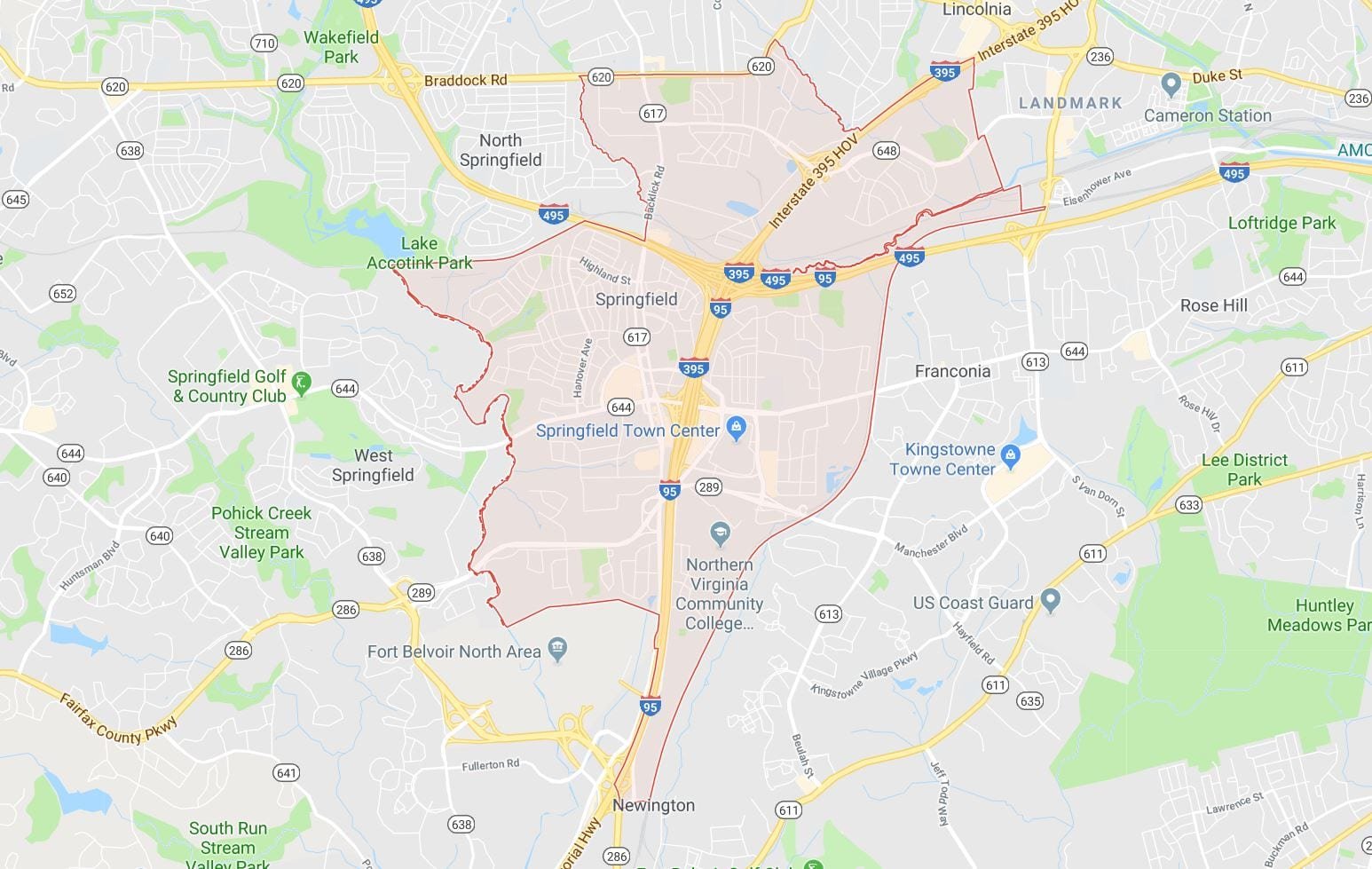
Adjacent Communities: Franconia, Burke, Annandale, West Springfield, and Newington
Distance to Washington, D.C.: ~16 miles southwest of downtown Washington, D.C.
Metro & Transit Access: Springfield–Franconia Metro Station (Blue Line); Springfield Town Center Bus Terminal with Fairfax Connector and WMATA bus services
Avg. Metro Commute to D.C.: ~30–45 minutes to downtown Washington, depending on destination and transfer requirements
Key Roads & Highways: I-95, I-495 (Capital Beltway), I-395, Fairfax County Parkway (Route 286), and Old Keene Mill Road (Route 644)
School System: Fairfax County Public Schools (FCPS)
Development Era: Major residential growth occurred during the 1950s–1980s, with continued commercial development around Springfield Town Center and the Franconia-Springfield transportation hub
Community Features: Springfield Town Center, Lake Accotink Park, extensive commuter access, regional shopping, and recreational facilities
Walk Score®: Springfield Town Center area ~50–65 (Somewhat Walkable); most residential neighborhoods ~25–45 (Car-Dependent)
Overview & Geography
Springfield, Virginia is an unincorporated community and Census-Designated Place (CDP) located in the southern portion of Fairfax County, Virginia, approximately 16 miles southwest of downtown Washington, DC. Because it is unincorporated, Springfield has no independent city government; all municipal services are provided by Fairfax County. This is an important distinction for homebuyers, as school assignments, tax rates, zoning decisions, and public services are all determined at the county level rather than by a municipal body.
Springfield is defined by several primary road corridors. Interstate 95 (I-95) and Interstate 495 (the Capital Beltway) intersect within Springfield at one of the region's most significant interchanges, commonly called the Springfield Interchange or "the Mixing Bowl." Franconia Road (Route 644), Old Keene Mill Road, Rolling Road, and Backlick Road serve as major internal arterials. Interstate 395 provides a direct northbound corridor into Arlington and Washington, DC. The Fairfax County Parkway (Route 7100) forms the community's western boundary and connects Springfield to employment centers in Reston, Herndon, and Tysons.
Springfield borders Franconia to the east, Burke to the west, Lorton to the south, and Annandale to the north. Historically, the area developed as a post-Civil War railroad stop along the Orange and Alexandria Railroad, with agricultural and residential growth accelerating after World War II as federal employment in the Washington region expanded. The community's commercial core was significantly redeveloped in the 2010s with the transformation of the former Springfield Mall into the current Springfield Town Center, which reopened in 2014.
Named Neighborhoods & Communities

Springfield encompasses a range of distinct neighborhoods and subdivisions, each with its own character. The following named communities are recognized within or immediately adjacent to the Springfield CDP:
South Run — South Run is one of the most peaceful and nature-filled areas near Springfield, Virginia. It sits in southern Fairfax County, close to Fairfax Station, Burke, and the Fairfax County Parkway. The neighborhood is known for large homes, wooded lots, quiet streets, and easy access to parks and trails.
West Springfield — West Springfield is one of Springfield’s most loved residential areas. It offers tree-lined streets, well-kept homes, strong community pride, and easy access to parks, schools, shopping, and major commuter routes. Many homes here were built from the 1960s through the 1990s.
Gambrill — Gambrill is a small, quiet pocket of Springfield, Virginia, near Gambrill Road and Gambrill Woods Way. It offers a peaceful suburban feel with larger homes, tree-lined streets, and quick access to parks, shopping, commuter routes, and daily conveniences. Homes here are mostly single-family houses, with many built in the late 1990s and early 2000s.
Daventry — Daventry is one of West Springfield’s most loved planned communities. It offers a rare mix of townhomes, single-family homes, and condos in one neighborhood. That gives buyers more choices than many nearby communities. The neighborhood includes about 212 single-family homes, 512 townhomes, and 160 condominiums.
Newington Forest — Newington Forest is one of Springfield’s best-loved planned communities. It has about 1,800 homes, including townhomes, split-level homes, and Colonials, with a setting that feels wooded, quiet, and established.
Pohick Hills — Pohick Hills is a quiet, wooded neighborhood in Springfield, Virginia, near Newington Forest and South Run. It offers a peaceful suburban feel with easy access to parks, trails, shopping, commuter routes, and Fairfax County schools.
Transit, Commute & Walkability
Metro Rail
Springfield is served by the Springfield-Franconia Metro Station, a terminal station on the Blue Line of the Washington Metropolitan Area Transit Authority (WMATA) rail system. From Springfield-Franconia, Blue Line trains provide a direct connection to Pentagon, Arlington Cemetery, Rosslyn, and onward to downtown Washington, DC stations including Farragut West and Metro Center. Typical rail travel time to Pentagon is approximately 12–15 minutes; to Metro Center approximately 30–35 minutes.
Road Commuting
Springfield sits at the confluence of I-95, I-495 (Capital Beltway), and I-395, giving residents multiple highway options. I-395 Express Lanes and I-95 Express Lanes (toll-managed) provide faster peak-hour options. Typical driving commute times: to Pentagon 15–35 minutes; to Crystal City / Amazon HQ2 (Arlington) 20–40 minutes; to Tysons Corner 25–45 minutes; to downtown Washington, DC 30–55 minutes. Times vary significantly with peak traffic on I-395 and the Beltway.
Parks, Landmarks & Community Life

Named Parks
Lake Accotink Park — A 476-acre Fairfax County park centered on Lake Accotink, a 55-acre reservoir off Highland Street. Facilities include a boat rental facility (pedal boats, kayaks, canoes), fishing access, a miniature golf course, carousel (seasonal), hiking and biking trails, and picnic areas. The park is operated by the Fairfax County Park Authority.
Pohick Stream Valley Park — A linear stream valley park running through Springfield with natural trail corridors and passive recreation opportunities.
Huntsman Park — A neighborhood park in the western Springfield area offering athletic fields and playgrounds.
Newington Forest Park — Community park within the Newington Forest neighborhood offering recreational fields and trail access.
Historic Landmarks
Springfield Railroad History — The community takes its name from a Springfield post office established in the mid-19th century along the Orange and Alexandria Railroad corridor (now the Virginia Railway Express line). The railroad's influence shaped the community's original commercial and residential grid.
Fort Belvoir (Est. 1917) — Originally known as Camp A.A. Humphreys, the installation adjacent to Springfield was established in 1917 and renamed Fort Belvoir in 1935. It is listed on the National Register of Historic Places as the site of significant military engineering history.
Community Events & Venues
Springfield's community events are organized primarily through the Fairfax County Park Authority and local civic associations. The Springfield Farmers Market operates seasonally at the Springfield Government Center vicinity. Springfield Town Center hosts recurring community events including seasonal festivals, outdoor concerts, and holiday programming. The Lee District Rec Center (operated by Fairfax County) provides year-round programming for residents, including fitness facilities, aquatics, and cultural programs.
Frequently Asked Questions
Is Springfield, Virginia a city or a county?
Springfield, Virginia is neither a city nor an incorporated town. It is an unincorporated community and Census-Designated Place (CDP) located entirely within Fairfax County, Virginia. This means it has no independent mayor, city council, or municipal government. All government services — including public schools, police (Fairfax County Police Department), zoning, and parks — are administered by Fairfax County. Property taxes are paid to Fairfax County. This is an important distinction for homebuyers comparing Springfield to independent Virginia cities such as Alexandria or Falls Church, which have separate school systems and tax structures.
What Metro station serves Springfield, Virginia?
Springfield is served by the Springfield-Franconia Metro Station, the southern terminal station of the Blue Line on the WMATA Metrorail system. The station is located off Loisdale Road and features a large parking facility, making it one of the most-used park-and-ride stations in the Washington Metro system. From this station, Blue Line service runs northbound through Pentagon, Crystal City, Rosslyn, and into central Washington, DC. Travel time from Springfield-Franconia to Pentagon is approximately 12–15 minutes; to Metro Center is approximately 30–35 minutes under normal conditions.
What school district covers Springfield, Virginia?
All public schools in Springfield, Virginia are part of Fairfax County Public Schools (FCPS), one of the nation's largest school districts with approximately 180,000 students. School assignment is determined by home address within FCPS attendance boundaries. The primary high school serving most of Springfield is West Springfield High School on Daventry Street. Middle and elementary school assignments vary by sub-neighborhood. Parents and homebuyers are advised to verify specific school assignments using the FCPS School Locator tool at fcps.edu, as attendance boundaries may change.
What is the National Geospatial-Intelligence Agency, and is it really in Springfield?
The National Geospatial-Intelligence Agency (NGA) is a U.S. federal intelligence agency responsible for geospatial intelligence (GEOINT) and satellite imagery analysis. The NGA's main campus is physically located in Springfield, Virginia along Brookfield Corporate Drive, making it one of the largest single employers in the immediate area. The campus employs thousands of federal civilian employees, military personnel, and defense contractors, and is a primary driver of housing demand in the Springfield, Burke, and Lorton corridor.
How far is Springfield, Virginia from Washington, DC?
Springfield, Virginia is approximately 16 miles southwest of downtown Washington, DC. By car via I-395 North, the drive ranges from approximately 25–50 minutes depending on traffic — peak-hour congestion on I-395 and the Springfield Interchange is significant. By Metro Blue Line, travel from the Springfield-Franconia station to downtown DC stations such as Farragut West or Metro Center takes approximately 30–40 minutes under normal operating conditions. Use of I-395 Express Lanes or I-95 Express Lanes can reduce peak-hour drive times.
What types of homes are available in Springfield, Virginia?
Springfield's housing stock is diverse, reflecting multiple decades of suburban development. The most common housing types are single-family detached homes (predominantly 3–5 bedrooms built between the 1960s and 1990s), townhomes (many in planned communities such as Newington Forest and Springfield Oaks), and condominium units near the Town Center and Metro station. The median home price in Springfield is approximately $545,000–$600,000, though prices vary considerably by sub-neighborhood, condition, and proximity to Metro. Buyers should verify current pricing with active MLS data.
Our Springfield Market Expertise
Our team has deep, transaction-level knowledge of the Springfield, Virginia residential market. We understand how sub-neighborhood location, school assignment, Metro proximity, and I-395 access all affect pricing and days-on-market in ways that aggregate statistics do not capture.
Our Springfield-specific services include:
Buyer Representation — Access to off-market opportunities, FCPS school boundary analysis, and commute-time assessments for I-395, Metro Blue Line, and HOT Lanes.
Seller Representation — Neighborhood-specific pricing strategy, staging guidance, and marketing to NGA, DLA, and Fort Belvoir buyer pools.
Relocation Services — Customized relocation support for federal employees, military personnel (PCS), and defense contractors arriving at Fort Belvoir, the NGA, or DLA.
Investment Analysis — Rental market analysis for single-family and townhome investors targeting the Springfield Metro corridor.
Ready to buy or sell in Springfield? Contact our team today for a no-obligation consultation. We combine current MLS data with on-the-ground neighborhood knowledge to help you move with confidence.
Authoritative Resources for Springfield Research
The following resources are recommended for independent verification of data referenced on this page. Each link is described by the specific information it contains.
Fairfax County Government — Springfield District — Official Fairfax County Lee District Supervisor's page; contains local government contacts, district-specific announcements, community meeting schedules, and constituent services for the Springfield area.
Fairfax County Public Schools — School Locator — FCPS official tool for identifying which elementary, middle, and high school a specific residential address is assigned to; essential for buyers verifying school assignments.
Lake Accotink Park — Fairfax County Park Authority — Official Fairfax County Park Authority page for Lake Accotink Park containing hours, amenity listings, boat rental information, trail maps, and seasonal programming details.
Springfield-Franconia Metro Station — WMATA — WMATA official station page for Springfield-Franconia Metro; contains parking information, fare details, accessibility features, Blue Line schedule, and connections to bus routes.
Springfield Town Center — Official website for Springfield Town Center; contains current tenant directory, hours, events calendar, dining options, and parking information for the 1.5-million-square-foot regional mall.
Fairfax County Real Property Tax Data — Fairfax County's official real property assessment database; allows users to look up assessed values, tax history, and property details for any parcel in Springfield or Fairfax County.
Fairfax County Park Authority — Trail Maps — Official Fairfax County Park Authority trail index; contains downloadable maps and descriptions for the Cross County Trail, Pohick Stream Valley Trail, and other multi-use trails accessible from Springfield.
